
In summary:
- Treat public transit as a shared space; simple etiquette like managing your backpack and yielding priority seats ensures a smooth flow for everyone.
- Understand the system’s logic, from the U-shaped Line 1 to why PRESTO is superior for transfers, to avoid common tourist and newcomer mistakes.
- Plan proactively by anticipating weekend maintenance patterns and learning how to find shuttle bus stops on the street level, not inside stations.
- Combine transit options strategically, using TTC or GO park-and-ride lots and understanding the unique roles of systems like the PATH and Blue Night Network.
You hear it before you see it: the distinctive chime of a Toronto streetcar bell. For a driver, it’s a warning. For a pedestrian, it’s a signal to look both ways. For a newcomer, it’s often the start of a deep confusion about the unwritten rules of getting around this city. Many guides will tell you the basics: “let people off first” or “have your fare ready.” But from my driver’s seat, I can tell you that navigating the TTC isn’t just about following rules—it’s about understanding the flow of a complex, living system.
Most advice focuses on what you should do, but rarely explains *why*. Why do cars get stuck behind a streetcar with its doors open? Why does tapping your credit card sometimes cause problems with a transfer to a GO train? Why does the subway map seem to lie about which way is “north”? The key isn’t to memorize a hundred different regulations. It’s to adopt an operator’s mindset: see the system as a whole, anticipate its movements, and understand your role within it, whether you’re on foot, behind the wheel, or on board.
This guide is different. It’s the insider’s perspective. We’re going to go beyond the surface-level tips. We will cover the essential etiquette that keeps the system moving, demystify the confusing parts of the subway network, and show you how to master payments and transfers. We will even explore how to strategically combine your car with public transit to conquer the entire Greater Toronto Area. Consider this your training manual for riding with confidence.
To help you master Toronto’s public transit, this guide breaks down the essential knowledge every rider and driver should have. The following sections provide a clear roadmap, from on-board etiquette to advanced navigation and payment strategies.
Summary: An Operator’s Guide to the TTC
- Backpacks and blue seats: the etiquette rules to avoid being hated
- Line 1’s U-shape: how to know if you’re going north or south in the loop?
- Maintenance weekends: how to anticipate shuttle replacement buses?
- Credit card or Presto: why is direct payment riskier for transfers?
- Blue Night Network: where does the bus de nuit stop when the subway is closed?
- How to combine car and public transport to cross the GTA efficiently?
- How to navigate the PATH underground network without getting lost?
- How to use the PRESTO system and the TTC to cross the Greater Toronto Area without stress?
Backpacks and blue seats: the etiquette rules to avoid being hated
From my driver’s seat, the single biggest cause of delays during rush hour isn’t traffic—it’s people. With ridership that can exceed 1.4 million passengers on a busy day, space is the most valuable commodity we have. Simple etiquette isn’t just about being polite; it’s a critical part of keeping the entire system flowing. The most common offense? The backpack. On a crowded 504 King streetcar, a backpack worn on your back effectively doubles your size. The rule is simple: if the vehicle is busy, hold your bag in front of you or place it between your feet. It’s a small change that creates a huge amount of space for others.
The second critical area is seating. The blue seats, known as Priority Seating, are not a suggestion. They are designated for passengers with disabilities, older adults, and pregnant people. When someone who needs that seat boards, you must give it up. It’s not a negotiation. We’re trained to watch for this, and it’s your responsibility as a rider to be aware. Pay attention when the streetcar or bus stops, especially near the second set of doors where the international accessibility symbol is displayed. Put your phone away and look up. Your awareness helps everyone have a safer, more comfortable ride.
Finally, let’s talk about the doors. When exiting, be ready to move as soon as the doors open. Hesitation at the doorway creates a bottleneck that holds up everyone behind you and, in the case of a streetcar, all the car traffic behind us. Have a destination in mind and move towards it decisively. These small acts of spatial awareness, when multiplied by thousands of passengers, are what make the difference between a smooth commute and a frustrating one.
Line 1’s U-shape: how to know if you’re going north or south in the loop?
The “U” in the Line 1 Yonge-University line is the Bermuda Triangle for many tourists and new Torontonians. You’re at Union Station, you want to go north, but there are two “northbound” platforms. Which one is correct? Understanding this is key to not ending up in the wrong part of the city. The line runs down University Avenue on the west side of the “U” and up Yonge Street on the east side. The mistake happens when you don’t differentiate between the two northern destinations: Vaughan Metropolitan Centre (west) and Finch (east).
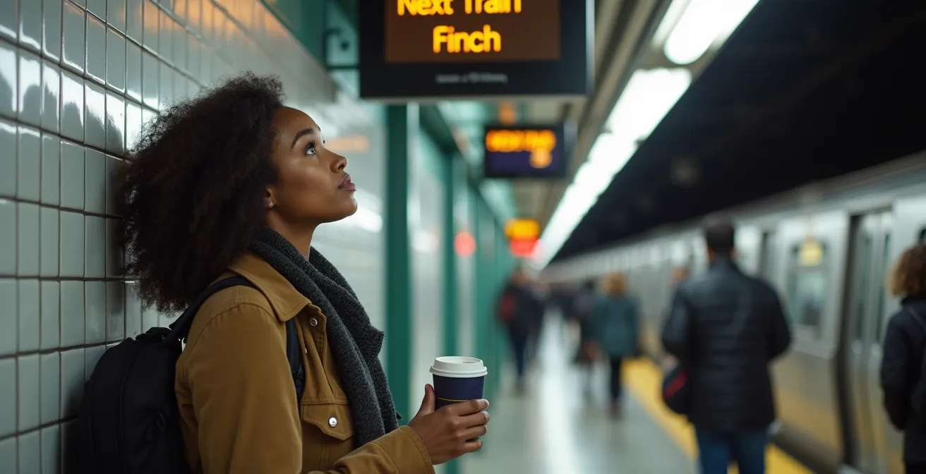
The easiest way to get it right is to think about your destination’s cross-street. Are you heading to a destination on or near Yonge Street, like Bloor-Yonge or Eglinton? You need the platform for trains going “Northbound to Finch.” Are you going to a place on the west side of downtown, like the Art Gallery of Ontario (St. Patrick station) or the Royal Ontario Museum (Museum station)? You need the platform for trains going “Northbound to Vaughan.” At Union Station, this distinction is crucial. As a case study in passenger confusion, the station’s layout frequently sends people to the wrong side of the loop, simply because both directions are technically “northbound” from there.
Look for the final destination on the signs above the platform and on the front of the train itself. Don’t just follow the crowd or assume “north is north.” Taking a moment to confirm if you need the Yonge side or the University side will save you from a frustrating detour and a trip back downtown to start over. It’s the most common navigational error we see, and it’s easily avoidable with a little bit of planning.
Maintenance weekends: how to anticipate shuttle replacement buses?
There’s nothing more frustrating for a rider than showing up to a subway station only to find it closed for the weekend. From an operator’s perspective, these closures are essential for safety—upgrading signals and maintaining tracks keeps the system reliable. But for you, the key is to anticipate, not just react. The TTC provides ample warning for scheduled closures, but you have to know where to look.
The most common mistake riders make is assuming the replacement shuttle bus will be in the station’s bus terminal. It won’t be. For safety and traffic flow, shuttle buses always pick up and drop off on the main street outside the station. Look for temporary signs—often a simple red and white “Shuttle Bus” A-frame sign on the sidewalk. If a closure is on the Yonge line, the shuttles will be on Yonge Street. If it’s on the University/Spadina line, they’ll be on the corresponding major road. Don’t go into the station; stay at street level.
You can become a pro at predicting these disruptions. Firstly, follow @TTCnotices on X (formerly Twitter) or set up a news alert for “TTC closure.” Secondly, learn the patterns. Major signal work often affects the same stretches repeatedly, such as St. Clair to Finch or St. George to St. Andrew. If your regular route passes through these zones, have an alternative in mind before the weekend even starts. This might mean taking a streetcar or even planning to use a GO train if it’s a viable option. A little proactive planning turns a major headache into a minor inconvenience.
Your Action Plan: Preparing for TTC Shuttle Buses
- Set up keyword alerts for ‘TTC closure’ and follow @TTCnotices on social media for advance notifications weeks before scheduled maintenance.
- Learn the pattern – signal work typically affects St. Clair to Finch or St. George to St. Andrew stretches of Line 1.
- Identify shuttle bus stops on the street level – they are NOT inside the station’s bus terminal but on the main street with temporary signage.
- Plan alternative routes in advance if you regularly travel through maintenance-prone sections.
Credit card or Presto: why is direct payment riskier for transfers?
Tapping your credit or debit card to pay your fare is convenient, especially for tourists. But for anyone making a multi-leg journey, especially one involving GO Transit or another regional system, it’s a risky move. The problem isn’t the payment; it’s the proof of transfer. A PRESTO card is designed as a system-wide passport. When you tap it, the card reader shows your transfer’s expiry time, and it communicates seamlessly with other transit systems in the GTA.
When you tap a credit card, the system knows you paid, but it doesn’t provide you with any visible proof of your two-hour transfer window. If a fare inspector boards and their machine has a connection issue, you have no way to prove you’re on a valid transfer. Furthermore, this method can cause major conflicts when connecting to GO Transit. Tapping a credit card on a TTC vehicle and then on a GO train can lead to being charged incorrectly, as the systems aren’t designed to reconcile a single credit card tap across different fare structures (flat fare vs. distance-based).
With a PRESTO adoption rate of 92.7% among regular riders, it’s clear that the dedicated card is the standard for a reason. It is the only tool built for seamless, multi-system travel. The choice is clear: for a single, one-way trip, a credit card is fine. For anything else, PRESTO is the only way to guarantee your transfers are properly recorded and you’re not overcharged.
This table breaks down the fundamental differences for regular commuters.
| Payment Method | Transfer Display | GO Transit Compatibility | Best For |
|---|---|---|---|
| PRESTO Card | Shows transfer expiry on reader | Seamless tap-off/tap-on | Regular commuters, multi-day stays |
| Credit/Debit Card | No visible transfer proof | Can cause fare conflicts | One-day tourists only |
| Virtual PRESTO | Phone displays status | Works across GTA systems | Tech-savvy frequent riders |
Blue Night Network: where does the bus de nuit stop when the subway is closed?
When the subway system closes for the night around 1:30 a.m., Toronto doesn’t stop. That’s when the Blue Night Network takes over. These are the bus and streetcar routes, marked with a distinctive blue sign and owl symbol, that run 24/7 or provide overnight service. As an operator, I can tell you these routes are a lifeline for shift workers, hospitality staff, and anyone enjoying the city’s nightlife. The service is surprisingly frequent, with most routes running every 30 minutes or less.
The most important thing to know is that Blue Night stops are the same stops used during the day. Major routes like the 320 Yonge bus simply trace the path of the Line 1 subway above ground. If you exit a subway station after it closes, just look for the regular bus stop pole on the street corner. The only difference is the added blue band on the sign, indicating it’s an overnight route. Don’t look for a special shelter or a different location; it’s integrated directly into the daytime network.
Living along a 24-hour route like the 320 Yonge or 301 Queen is a significant advantage for many Torontonians. This constant connectivity provides a major safety and lifestyle benefit, which in turn impacts rental demand and property values in those corridors. It’s a key piece of city infrastructure that makes car-free living more viable. So next time you’re out late, remember the Blue Night Network is your reliable ride home, using the same familiar stops you use all day.
How to combine car and public transport to cross the GTA efficiently?
For many in the Greater Toronto Area (GTA), a “car-only” or “transit-only” commute isn’t practical. The smartest commuters use a hybrid approach: the “Park and Ride.” But there’s a strategy to it. The biggest mistake is aiming for the parking lot at the very end of a subway line, like Finch or Kipling. These lots are often full before 7:30 a.m. on weekdays. The insider’s tip is to target a station one or two stops *before* the end of the line. For example, instead of Finch, try Sheppard-Yonge. Instead of Kipling, try Islington. These lots have better availability later into the morning.
The second part of the strategy is choosing the right system for your destination. If your entire journey is within Toronto, a TTC commuter lot is your best bet. But if you’re crossing the entire GTA, say from Pickering to Etobicoke, using a GO Transit station is far more efficient. GO stations typically offer ample free parking and connect you to a rail network designed for long-distance travel, bypassing Toronto’s downtown traffic entirely.
Finally, there’s the “Kiss & Ride.” If you’re being dropped off, tell your driver to follow the etiquette: it’s for active drop-offs only, with a two-minute maximum stop. The driver should stay in the vehicle. This keeps the lane moving for everyone. And for those traveling from the airport, the most efficient combination is clear: the UP Express connects Toronto’s airport to Union Station in just 25 minutes, where you can then seamlessly transfer to the TTC or GO Transit.
How to navigate the PATH underground network without getting lost?
Toronto’s PATH is more than a shopping mall; it’s a 30-kilometer underground city connecting over 75 buildings and serving more than 200,000 people daily. For downtown workers, it’s essential infrastructure for a weatherproof commute. But for the uninitiated, it’s a labyrinth. The key to navigating it without getting lost is to ignore the store names and focus on two things: the color-coded directional system and major building landmarks.
The system is based on the letters P-A-T-H, each corresponding to a direction and a color. It’s simple once you know the code:
- P (Red) points you South.
- A (Orange) points you West.
- T (Blue) points you North.
- H (Yellow) points you East.
When you’re at an intersection, look up. The signs on the ceiling will use these colors to guide you. Following the blue “T” will always lead you generally north.
However, signage can be inconsistent. The more reliable method is landmark-based navigation. Instead of trying to follow signs to a specific subway station, navigate towards a major, unmissable building. For example, if you know Union Station is south, navigate towards the TD Centre or Royal Bank Plaza. If you know you need to get to the Eaton Centre, look for signs pointing towards it. You can also find “secret” subway connections that aren’t obviously marked, often by cutting through the food courts of major office towers like First Canadian Place. Using these buildings as your “North Star” is often more effective than relying on the signs alone.
Key takeaways
- Mastering transit is about understanding system flow, not just rules. Etiquette like managing bags and yielding priority seats is about collective efficiency.
- Anticipate, don’t just react. Learn the patterns of weekend maintenance and know that shuttle buses stop on the street, not in the station.
- Use the right tool for the job. PRESTO is built for transfers and multi-system travel across the GTA; credit cards are for simple, one-off trips.
How to use the PRESTO system and the TTC to cross the Greater Toronto Area without stress?
The PRESTO card is your passport to the entire GTA transit network, but using it effectively requires understanding a few core principles. The most powerful feature is the two-hour transfer window on the TTC. This means you can tap your card, run an errand, and get back on a vehicle heading in any direction within two hours on a single fare. The key is to plan your short trips to fall within this window; a 90-minute round trip costs the same as a one-way journey.
The most critical rule, and the one that trips up so many people, is the difference between tapping on the TTC and GO Transit. On the TTC (buses, streetcars, subway), it’s a flat fare system. You tap ON, but you NEVER tap OFF. Tapping off will not do anything, but it can create confusion. On GO Transit, it’s a fare-by-distance system. You MUST tap ON at the start of your journey and tap OFF at the end. Forgetting to tap off means you’ll be charged the fare to the furthest point on that line, which can be a costly mistake.
With the use of cash for weekly TTC rides down to 3.6%, digital payment is the norm. Choosing between a physical PRESTO card and a virtual one in your mobile wallet comes down to your personal habits. A physical card can be lent to a friend and works even if your phone battery dies. A virtual card is always with you but is tied to your device. For truly seamless travel, the ultimate pro-tip is to set up autoload on your PRESTO account. This ensures you never have to worry about a low balance holding you up at the fare gate, keeping your journey across the GTA completely stress-free.
Your PRESTO & GTA Travel Audit Checklist
- Fare Method: Are you using PRESTO for any trip involving a transfer, especially with GO Transit?
- Tapping Habits: Do you remember the golden rule: NEVER tap off TTC, but ALWAYS tap off GO?
- Transfer Window: Are you leveraging the two-hour TTC transfer for short round trips to maximize fare value?
- Card Choice: Does your choice (physical vs. virtual) match your needs for convenience and backup options?
- Balance Management: Is autoload enabled on your PRESTO account to prevent fare interruptions?
Now that you have an operator’s perspective on how the system works, the next step is to put these strategies into practice. On your next trip, ride with the confidence that you’re not just a passenger, but a knowledgeable participant in the city’s daily rhythm.